Wellness
Portland's Best Walking Trails Rated by Distance and Difficulty
From a flat riverside stroll to a lung-burning ridge climb, here's where Portland's trail network delivers the most for your effort.
4 min read
Wellness
From a flat riverside stroll to a lung-burning ridge climb, here's where Portland's trail network delivers the most for your effort.
4 min read
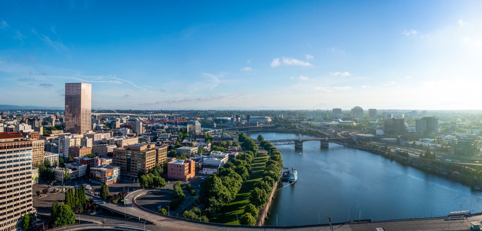
Portland has more than 12,000 acres of parkland threaded through its neighborhoods, and this Fourth of July weekend, most of it will be packed. That's actually useful information: trail traffic patterns on a holiday weekend reveal which routes reward walkers at every fitness level, and which ones quietly punish beginners who underestimate the grade.
Heat records are falling across the globe this summer, and Portland is not immune. The National Weather Service logged 11 consecutive days above 85°F in June 2026 at PDX, pushing many residents toward early-morning trail sessions before 9 a.m. The Portland Parks & Recreation department reported a 34 percent spike in trailhead counts at Forest Park compared with June 2025, according to figures released last month. That kind of surge makes knowing your route — its length, its elevation change, its sun exposure — a practical health decision, not just an athletic preference.
Start with the Springwater Corridor Trail if you want flat, paved, and forgiving. The full route runs 21 miles from the Eastside Esplanade near the Hawthorne Bridge all the way to Boring, Oregon, but the stretch between the Esplanade and Sellwood Riverfront Park — roughly 6.5 miles one way — is the sweet spot for casual walkers. Elevation change is negligible, the path is wide enough for strollers and cyclists to share, and water fountains reopen at the Oaks Bottom Wildlife Refuge trailhead around mile two. Difficulty: easy. Time to complete a Sellwood-and-back: 2 to 2.5 hours at a comfortable pace.
For those ready to add modest hills, Wildwood Trail's lower section inside Forest Park offers a gentler introduction to the park's 30-plus miles of interconnected paths. Entering from the Pittock Mansion parking area off NW Barnes Road, the first 3 miles heading north toward Firelane 1 gain about 400 feet of elevation over rolling terrain. The canopy here stays dense even in July, dropping the ambient temperature by 8 to 10 degrees compared with nearby surface streets. Difficulty: moderate. This segment suits walkers who can sustain 45 to 60 minutes without a break.
Council Crest Park sits at 1,073 feet above sea level, the highest point within Portland city limits. Getting there on foot via the Marquam Trail from Duniway Park on SW Barbur Boulevard is a 4-mile round trip that climbs roughly 700 feet. The trail surface switches between packed gravel and rooted dirt, and two sections near the summit push a 12 percent grade. Bring water. Difficulty: challenging. The Portland Trails Association, which has maintained signage on this route since 1994, recommends trekking poles for hikers with knee concerns.
Powell Butte Nature Park's Summit Loop, accessed from SE Powell Boulevard in the Centennial neighborhood, is 9 miles of interconnected trails with an elevation gain of around 600 feet. The exposed meadow at the summit offers unobstructed views of four Cascade peaks on clear days, and the Oregon Department of Forestry maintains a fire-watch station there that's been active since 1937. The Orchard Loop inner trail cuts the full circuit to about 3.5 miles for those who want the summit without the full perimeter. Difficulty: moderate to challenging depending on chosen route.
Portland Hikers, the volunteer-run trail resource at portlandhikers.org, keeps condition reports updated within 48 hours for all four of these routes, including seasonal alerts about downed trees or mudslides on Wildwood after rain events. The site is free and lists trailhead GPS coordinates alongside transit directions — the No. 51 bus stops within a quarter mile of the Powell Butte main entrance on SE Foster Road.
If you're new to trail walking, start on the Springwater Corridor and build a baseline before adding elevation. Wear sunscreen on the Powell Butte summit meadow regardless of cloud cover, apply it before you leave the car, and carry at least 16 ounces of water per hour of planned walking time. Check in with a Portland-area physician or sports medicine clinic before attempting Council Crest or the full Powell Butte perimeter if you have cardiovascular or joint concerns.
About this article
Published by The Daily Portland
Spread the word
Daily brief
Free, in your inbox before 7am. Weekdays.
The Daily Network — local news across Australia